
Cattle owners, as well as their accountants and lenders, are turning to aerial imagery for efficient verification of livestock inventory. The most common forms of aerial imagery used for counting livestock are drone imagery and satellite imagery. But which type of imagery is better: drones or satellites?
There are a number of factors to consider when comparing drones with satellites: efficiency of image capture, image quality, the ability to see through trees (when needed), cost, and scheduling.
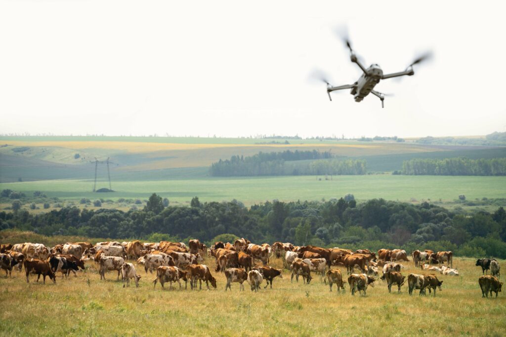
Ease and Speed of Image Capture
When flying an automated flight mission to count cattle on feedlots, a drone can image 200-300 feedlot pens per hour. Thus, even the largest feedlots can be documented by drone in just a few hours.
When flying a “lawnmower pattern” flight mission over a cattle pasture, a drone can image up to 250 acres in an hour. However, it is important to be aware that counting cattle on drone images procured in this way can be problematic. Specifically, if some cattle are moving in the same direction as the drone, those animals will be “detected” multiple times during the drone flight, resulting in an over-count. On the other hand, if a group of cattle are moving in the opposite direction of the drone, it is possible that the drone never captures imagery of these bovines, resulting in an under-count. Thus, mapping-based approaches for counting cattle (or any moving objects) are inherently problematic.
For accurate counting of cattle on large ranches, it is important that the cattle be gathered together in a corral or a corner of the pasture so that the drone can capture a single photo of an entire herd (or a portion of the herd). If the cattle are spread over a large ranch, this can be extremely labor-intensive and time-consuming and discourage ranchers from counting their cattle. This is where satellite imagery comes in.
A satellite can capture 1000 hectares (2500 acres) in a single image. This vast field-of-view enables an entire feedlot to be captured in just one photo, and grazing cattle that are constantly on the move can be imaged in a single snapshot. If cattle are grazing on multiple pastures within a 1000 hectare area, all of these herds can be imaged and counted simultaneously, with no manpower at all!
Image Quality
Flying a drone 90-120 m (300-400 ft) above the ground yields excellent image quality for counting large mammals such as cattle; this excellent image quality leads to very high accuracy for counting cattle based on these images. For example, our AI-powered count provides more than 99% accuracy for counting cattle on drone imagery.
Satellite image quality has been improving over time; some of the best commercially available satellite images have 30-50 cm pixel resolution. This translates into roughly one-tenth to one-fifth of the resolution of drone imagery. Because of the reduced image quality, cattle that are bunched together may not be counted accurately, and it may be impossible to differentiate between a cow and a similarly-sized boulder, for example. As a result, the accuracy of cattle counting on satellite imagery is generally 90% or more, depending on herd concentration and terrain. While this level of accuracy may be sufficient for some scenarios, it may not be ideal for collateral verification.
Seeing Through Trees
On large ranches with significant tree cover, drones with thermal imaging capabilities enable cattle producers to find and count cattle even when they are not visible to the sky by optical imaging alone. In contrast, satellite imagery can only be used to find livestock that are visible by optical imaging. In fact, not only can satellite imagery not see through trees, but satellite imagery can be problematic in areas that see regular cloud cover since the cloud cover can obscure the cattle on the satellite image.
Cost of Imaging
Drones that cost only $1000-$2000 USD provide excellent quality imagery from as much as 90-120 m (300-400 ft) above the ground. In contrast, a single satellite image can easily cost more than purchasing a drone! Nevertheless, for capturing images of large regions (>1000 hectares), satellite imagery may work out to be cheaper than drone imaging due to the cost of manual labor associated with drone imaging.
Scheduling Flexibility
If it is important that the imaging be performed on a particular day, both drone imaging and satellite imaging can present a challenge. Drone imaging can typically be scheduled for any particular day, but occasionally extreme weather (e.g., heavy rain, snow, or wind) can render it unsafe to fly. Consequently, it is always recommended that drone flights be scheduled with 1-2 backup dates in case of extreme weather.
Satellite imaging, like drone imaging, is dependent on weather because visibility will be limited on satellite imagery during heavy rain or snow. Unfortunately, even when the weather forecast looks clear, satellite imaging typically cannot be scheduled for any particular day. Instead, a 7+ day window is generally needed to schedule the satellite image acquisition, and you won’t know in advance when during the 7-day window the image will be taken since this depends on satellite trajectory, among other factors. Consequently, it may be impossible to correlate the satellite image with a “boots on the ground” inspection.
This 7-day window can also be problematic for cases where cattle need to be imaged at multiple facilities simultaneously. For example, if cattle need to be inspected for a single customer in multiple states, satellite image acquisitions for the different locations may occur on different days. In contrast, drone imaging can be performed in multiple states simultaneously by simply coordinating with multiple regional drone pilots. The 7-day window also precludes the use of satellite imagery for inspection scenarios when time is of essence and the inspection needs to be performed immediately.
Conclusion
While the costs associated with image acquisition by both drone and satellite depend on site size and location, among other factors, drone-based imaging will often be substantially cheaper than satellite imagery. For feedlots, as well as for ranches where gathering cattle prior to imaging is feasible, drone-based imaging is likely to be your method of choice. However, for large ranches with minimal tree cover where gathering cattle is not feasible, satellite imagery may be the better option.